Posted on March 10, 2021 by ccable -
There are several ways to get to this trail. You can work your way to the Schoolhouse Gap Trail from Laurel Creek Road to meet this trail, but you have almost 1,300 feet of climbing if you choose this way. Another access point is to park in Cades Cove and head out on the Crooked Arm Ridge Trail to meet up with the trail, as described here. If you are looking for a quiet trail without the crowd, this is the one for you.
The trail goes by a small spring that provides water for the camp, and then continues through the woods. Like most forests in the park, this area was harvested in the early 1900s before becoming part of the National Park. You’ll find newer trees growing in this area as the forest continues to recover from the logging efforts.
Erosion in this area can make it tricky to navigate, so make sure you are paying attention. You’ll need to rock hop a small spring, and then the trail begins to switch back as you move away from the ridgeline.
The trail will pass Whiteoak Sink between 2.5 and 2.75 miles and a famous cave called the “blow hole.” Due to White Nose Syndrome, a disease that infects bats, the cave is closed to humans. You’ll pass several cottages or homes that lie just outside the park boundary, a reminder of what the park would be like today if it wasn’t protected.
Posted on March 10, 2021 by jmuir -

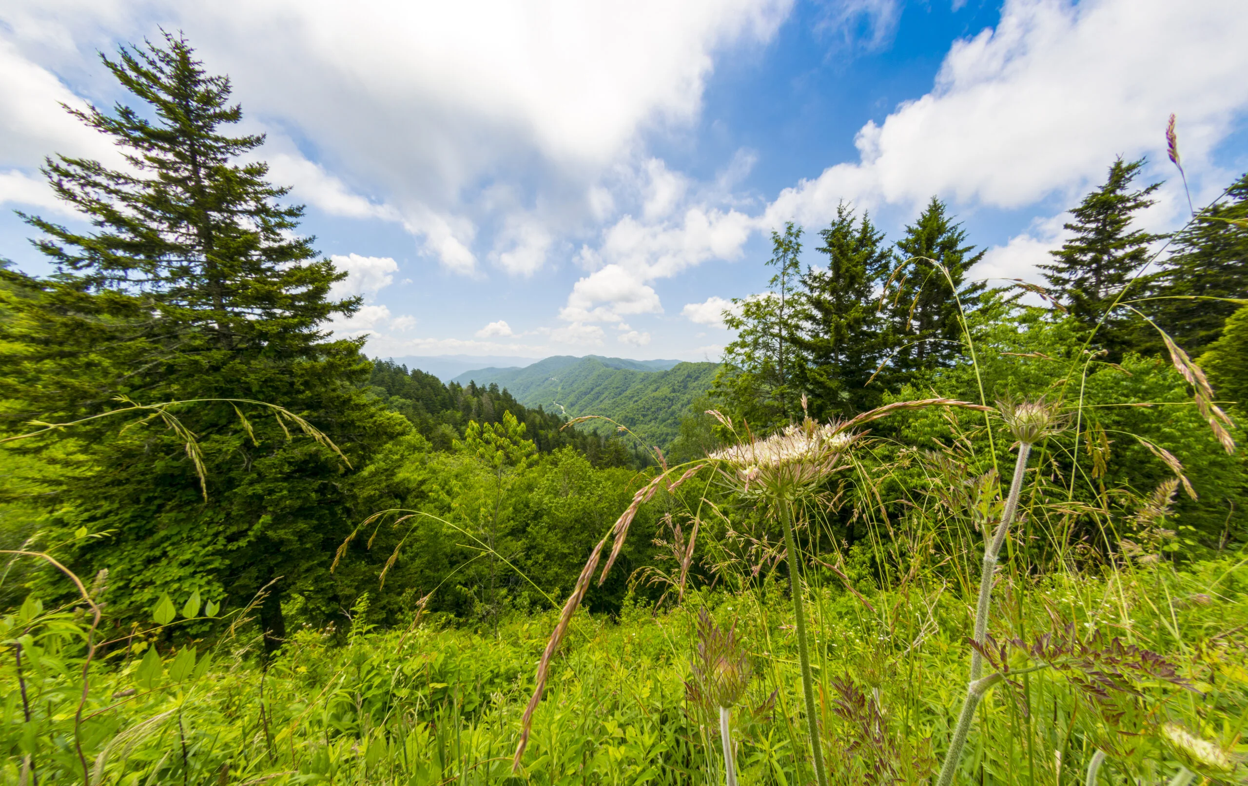
Find the Anthony Creek Trailhead near the horse camp in Cades Cove. This route starts out on easy trail. You’ll cross Anthony Creek multiple times along the way, but none of the crossings are too difficult. Enjoy your surroundings as you pass beneath beautiful rhododendrons and through hemlock groves. Take note, however, as the trail steepens on its final approach to the Bote Mountain Trail. Upon reaching the intersection with the Bote Mountain Trail, head south to continue climbing towards the Appalachian Trail.
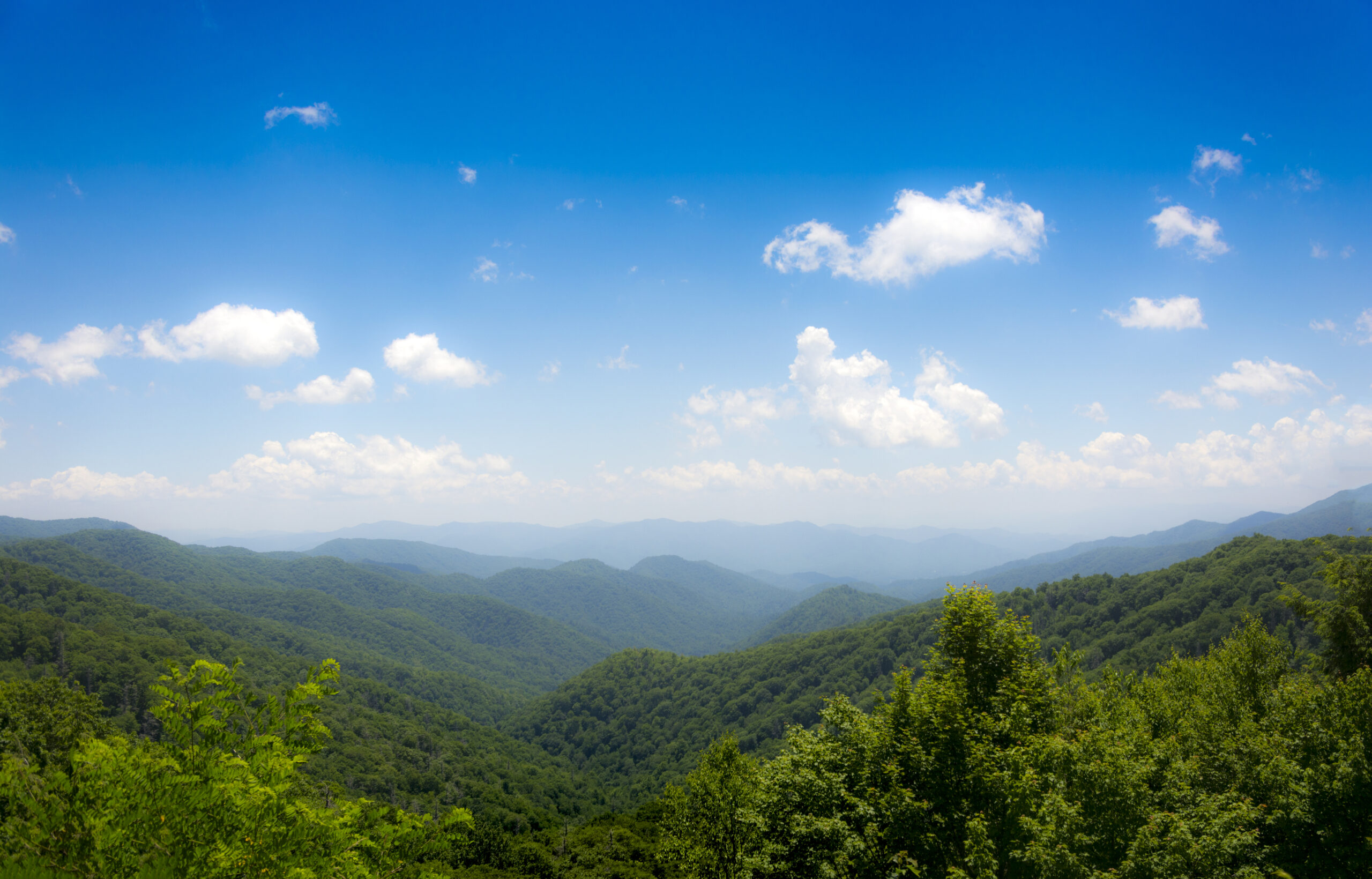
You’ll have moved away from the creek by this point, so the rest of the ascent will be dry. Soon enough, you’ll reach the ridgeline, and the Appalachian Trail. Head west on the white-blazed Appalachian Trail. Keep an eye out, as you’ll soon be nearing Spence Field. The trail will lead you right through the middle of the field, so take your time to enjoy this section.
Views will open up on either side, and you’ll be able to see the Smokies as they roll into the distance. While technically the field is a “grassy bald,” the views are incredible, and the going is easy. Additionally, there’s a shelter located just off the trail if you’re looking for a good place to spend the night. Feel free to explore as much or as little of this section as you’d like. If you’re feeling extra ambitious, you can continue east on the Appalachian Trail towards Thunderhead Mountain. If you decide to stick to Spence Field and have taken in the views and are ready begin the return journey, you’ll start moving west along the Appalachian Trail.
Posted on March 10, 2021 by ccable -
Roughly 5.6 miles from the Townsend “Y” headed toward Cades Cove, the Turkeypen Ridge Trail lies just off of Laurel Creek Road.
You will cross a small branch of Laurel Creek as the trail ascends, passing old fields ablaze with wildflowers such as azaleas and trillium. Once you pass through a gap in the mountains, the trail levels out and follows the ridgeline, bringing you to the cooler, moist hollows closer to the mountain. The forest changes from pine and oak to that of rhododendron, mountain laurel, and other hardwood.
The last .75 miles is a descent to Dorsey Gap, where you can return to your car via the path you came, or or head right and follow the Schoolhouse Gap Trail back to Laurel Creek Road.
Posted on March 10, 2021 by jmuir -
The trailhead sits just before the entrance to Tremont Institute – it sits right behind the pump house at the top of the hill. The trail starts climbing and comes to a fork, where you can follow the trail to the left or take a right to visit a maintained cemetery where many of the families in the area were buried. You’ll notice a high number of children buried here, which speaks to the high infant mortality rate in the 1800s and early 1900s. Family names you’ll see in the cemetery are Moore, Stinnett, Carlyle, Cook, and McCarter. These families lived in the Tremont area, making a life for themselves living off the land.
Once you have looked around, you can go back the way you came to pick up the trail or take a rough path through the woods to rejoin the West Prong a little further up the trail. If you go back to the trail, you’ll work your way up the trail, and you’ll see a hog trap off to the right, which is used to capture wild boar, an invasive, non-native species that destroys vegetation and native animals. As the trail climbs Fodderstack Mountain, the West Prong can be heard below the trail and views through the open woods provide opportunities to take in the surrounding hills and creek valleys.
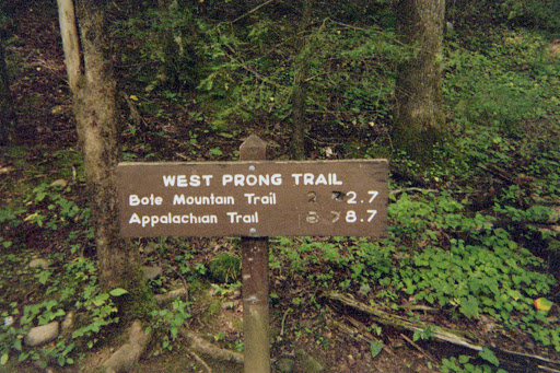
After climbing for about a mile, the trail begins a mile long descent to West Prong where wildflowers can be seen in wet areas beside the trail. An easy rock hop over a side creek leads you to Campsite #18. There are several campsites on both sides of the stream for people who want to camp overnight. Once you pass the campsite and cross a foot log, the trail goes to the right and starts climbing again. While not steep, it doesn’t level off for the rest of the trail. Bote Mountain Trail is the end of the West Prong Trail. You have several options when you get to the junction. You can go back the way you came, or take the Bote Mountain Trail.

Recent Comments