Posted on March 10, 2021 by ccable -
Roughly 2.5 miles from the Cooper Road Trail near the Abrams Creek Campground, the Goldmine Road Trail ascends a steady 0.8 miles, providing further access to the Cane Creek Trails and Goldmine Gap.
The footpath alternates between sections that are both rocky and rough, and calmer sections that are sandy and smooth. The climb reaches a steady 300 feet of elevation gain along an old road toward the park boundary.
The trail continues outside of the park for another 0.2 miles until the trail ends at the park boundary, which is only a hundred yards or so from a residential street in the Top Of The World Community, accessible from the Foothills Parkway.
The trailhead is 2.5 miles from the Cooper Road Trail near the Abrams Creek Campground.
Posted on March 10, 2021 by jmuir -
Gregory Bald is a 10-acre grassy meadow, and is one of two balds maintained by the park. The Bald is named after Russell Gregory, an early homesteader in the Cades Cove area. He and other cove residents used the meadow to graze cattle during the spring and summer when cove fields were used for growing crops. Like most cove residents Gregory supported the Union during the Civil War, but he was ambushed and murdered by Confederate guerillas from North Carolina in 1863.
Posted on March 10, 2021 by jmuir -

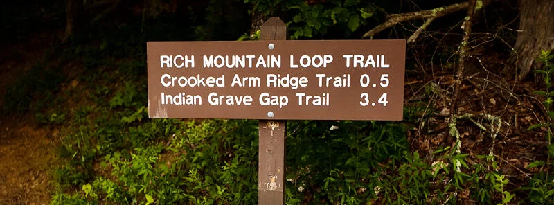
The Indian Grave Gap trailhead is located on the Rich Mountain Road and is accessible via the Crooked Arm Ridge Trail or the Rich Mountain Loop Trail from Cades Cove in the winter – so it can be a winter outing if you want to continue on. The trail begins climbing up the flank of the mountain as it leaves Rich Mountain Road and is wide in this portion because it was used by the power company to service power lines going into Cades Cove.
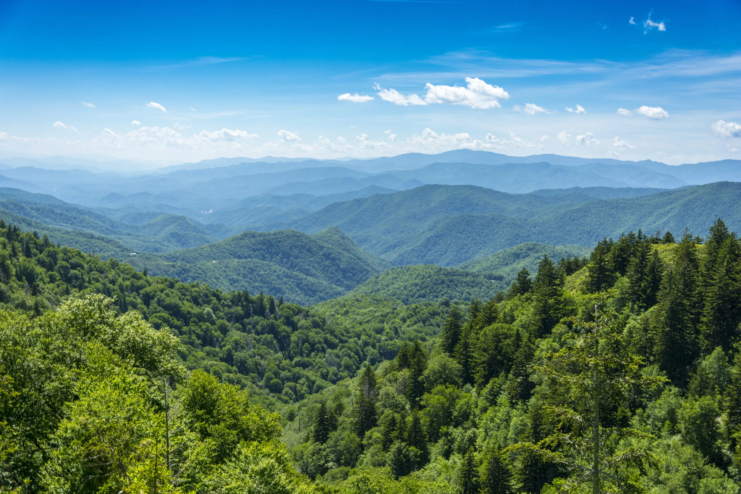
Near the first mile, the trail climbs more steeply (1,000 feet in a mile) as the pine forest transforms into a hardwood forest with oaks, maples, silver bells, and other trees. There’s a great view of Cades Cove near near the top of Tater Ridge where the trail intersects with Rich Mountain Loop. After mile 1.9, you’ll run into Campsite five, and the trail goes straight for above a quarter mile before arriving at Cerulean Knob, where a small spur trail leads to the highest point on Rich Mountain.
In the small opening, cement blocks that were once the foundation of the old Rich Mountain Fire Tower remain. The main trail continues east rolling up and down for another mile and a half, with wildflowers lining the trail. Views of Dry Valley and Townsend, both of which lie outside the park, are offered on the left hand side, while obstructed views of Cades Cove are off on the right.
Posted on March 10, 2021 by ccable -
The trailhead is on the Laurel Creek Road on the way to Cades Cove, 5.6 miles from the Townsend “Y.” Parking is on both sides of the road. This trail provides the shortest hike to Spence Field via the Bote Mountain Trail.
While it covers 1.8 miles, the trail gains 1,200 feet of elevation in a steady climb toward Bote Mountain Trail. Following the Sugar Cove Prong, there are a couple easy rock hop creek crossings at the start of the trail. Hiking under hemlock, tuliptree, and other hardwoods, you’ll pass the ruins of a homestead, as evidenced by the remains of a foundation and chimney.
When you emerge on the wider Bote Mountain Trail, you can turn right and head up the Bote Mountain Trail to the Appalachian Trail, which provides easy access to the popular Spence Field area.
Posted on March 10, 2021 by ccable -
The trailhead is located 1.3 miles up the Cooper Road Trail from the Abrams Creek Ranger Station on the right hand side of the trail. The trail ascends through old farmland, flourished by a forest of hemlocks and white pines. If you look closely, you’ll notice a small spring that seems to come out of a hemlock.
You will hike along a pine ridge that drops into the Abrams Creek Drainage, following Abrams Creek. The terrain rolls through this part of the journey, making it more than an easy trail. Campsite #17 sits at mile 1.6, near Abrams Creek and an old homesite. You can source water from the creek here, but make sure to sterilize before drinking.
As you approach the Hatcher Mountain trail, you’ll notice you gain 200 feet of elevation in a .4 mile stretch. Near the end of the trail, damage from an EF4 tornado in 2011 can still be seen.
From here, you have several options. Abrams Falls is 1.9 miles away if you turn right and follow the Hatcher Mountain Trail and the Abrams Creek Trail. You could also take the Hannah Mountain Trail and turn right on the Rabbit Creek Trail to follow it back to the Abrams Creek Ranger Station and your car. You can also return via the the path that you traveled.
Posted on March 10, 2021 by jmuir -

The trail starts behind a dorm that is up a gravel road from the Tremont Institute. The trail starts climbing immediately, and will continue until about 2.5 miles into the route after gaining about 1,200 feet of elevation gain. While there is a lot of climbing, it’s an easy trail to get to and a quiet trip once you get there. You’ll start to get views of the Middle Prong of the Little River and glimpses of Walker Valley.
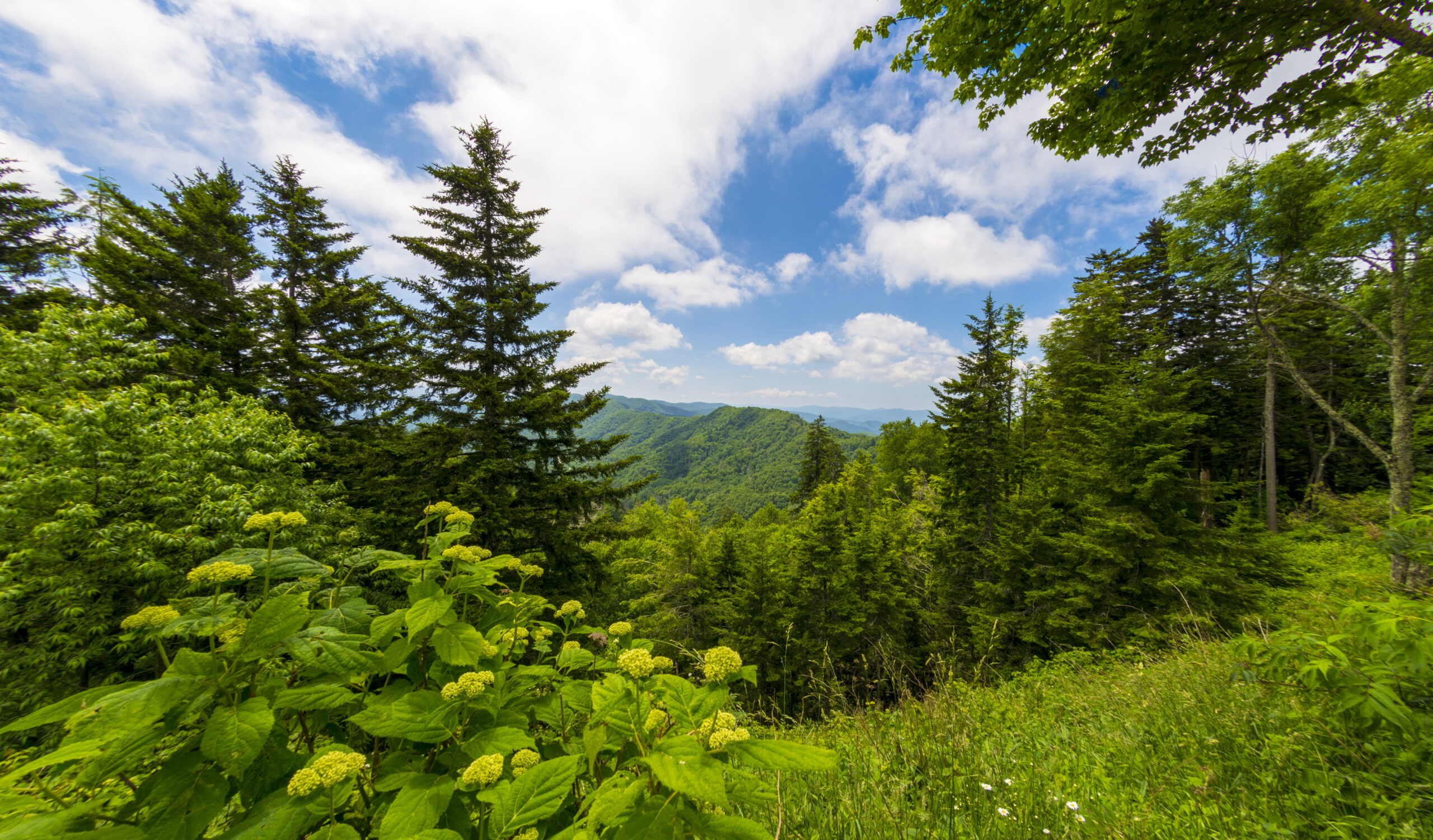
After the first half mile, the views fade and you start your quiet journey through woods as the sounds of cars and Tremont fade. You’ll pass through a pine forest, where you can witness the work of the Southern Pine Bark Beetle. As it burrows through the outer bark and feeds on the inner bark of a tree, room for the next generation of trees is made – creating a natural cycle.
You continue to move up Mill Ridge as you move between cool, moist valleys and dry ridges. Once you reach the saddle, a low point on Lumber Ridge, there’s a nice place to take a break. The final mile of the trail is relatively flat as you make your way to Buckhorn Gap. You’ll pass through stands of oaks, huckleberries, and other trees, causing it to be a popular place for animals to find food. You’ll finally arrive at Buckhorn Gap, where the trail meets the Meigs Creek Trail and the Meigs Mountain Trail. You can either return to your car via the path you came, or you can take one of the trails.
Posted on March 10, 2021 by ccable -
If you are headed to Cades Cove, at .2 miles from the Townsend “Y,” turn left onto Tremont Road and continue for a little over five miles on the main road (it turns to gravel) to a gate and parking circle. Your trail starts by crossing a high bridge over the Middle Prong River and into a flat area, the location of an old lumber camp. The trail is wide, and the Lynn Camp Prong follows the trail on the left. The trail rises higher over the river, and you’ll find wildflowers throughout the area.
Take time to notice chutes, falls, and pools in the river as you make your way up the trail. Near the end of the first mile, there is a bench where you can rest. There is a small waterfall in this area that is the remains of old splash dams, which were used by the loggers to help get logs down the mountain to the sawmill in Townsend. The trail levels out as it follows the creek, and another bench beside the road is provided for you to rest and take in more wildflowers.
Two miles in, there is a narrow trail to the right that leads to an old car frame, which speaks to the area’s use as a Civilian Conservation Corps (CCC) camp during the Great Depression. As you continue on the trail, you’ll encounter the Panther Creek Trail, which goes off to the left as your trail narrows straight ahead. The Middle Prong CCC Camp was built in this area as crews constructed roads in the park between 1933 and 1937. As the climb continues, you’ll cross a bridge that traverses Indian Flats Prong before the trail starts to turn away from the creek – prepare for a steepening series of switchbacks. The trail ends where several trails intersect.
Posted on March 10, 2021 by jmuir -

Your hike begins with crossing Mill Creek, so don’t put your shoes on just yet from the Cades Cove parking area. Once past this crossing, the trail is set on a mountain crossing, all below 2,400 feet, but moves quickly upwards toward Coon Butt Mtn. The descent out of the mountain heads toward campsite #15, which is a nice site if you are staying the night. Look around before you choose your home for the night – there is one site right on the water and one further up into the woods. This is a good place to fill up your water supplies.
To continue on, you’ll need to cross this creek, and the best place to cross is directly in line with the trail across the creek (too deep for boots/shoes). Once back on the trail, you’ll climb up Pine Mountain to about 2,200 feet. The top is the only place able to get a cell signal (with grand views once on top). The descent is fairly steep, so pay close attention. The bridge crossing is out over Abrams Creek so the safest place to cross this is again right across from the trail on the other side. The water can be swift so you may want to start down a bit further to end at the trail. You can end here or continue the loop. Little Bottoms Campsite #17 is another well-groomed, very popular location, so privacy is fairly nonexistent.
Posted on March 10, 2021 by jmuir -
To reach the trailhead, you can either take the Rich Mountain Road from Cades Cove to the park boundary at Rich Mountain Gap or access the area through Dry Valley. The Rich Mountain Trail begins to climb immediately as you make your way upward, passing through Christmas ferns and pine-oak forests.
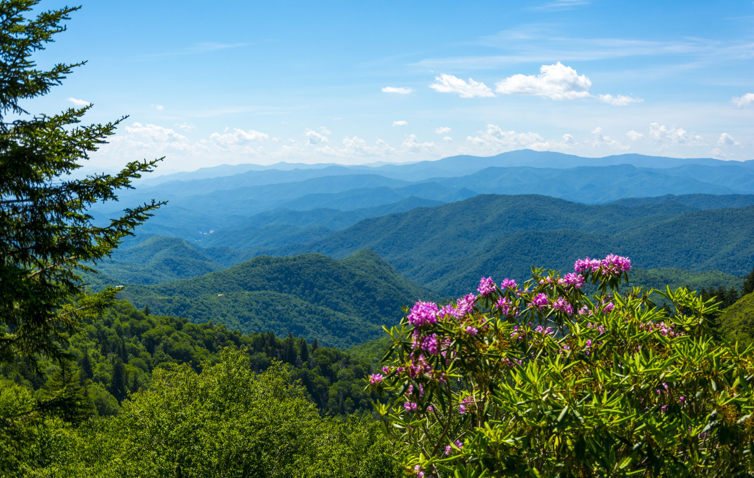
At .8 miles into your journey, you get views of the western end of the park, even though it is more than likely obstructed. At 1.2 miles you reach the park boundary with some partial views of Dry Valley.
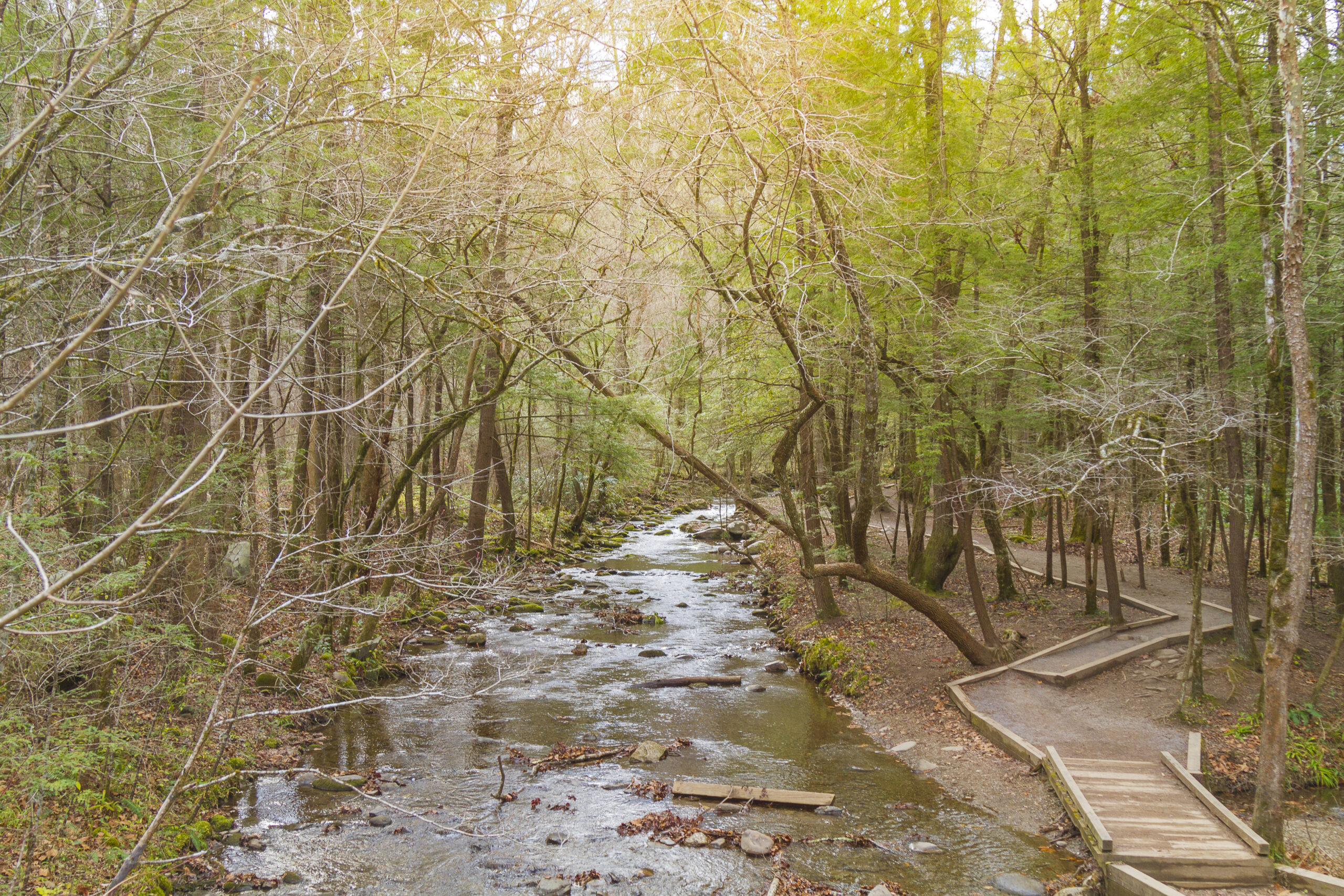
As the trail progresses, the creek meets the trail and a small cascade below the trail can be seen, with rock hops being necessary to cross the water. The trail reaches the top and dries out when you enter Campsite give in a tiny cove on Double Mountain.
For people spending the night, there is a small spring located about 100 yards downhill, marked by a trail sign. At this point, you can either return to your car, or go a little further and take the Indian Grave Gap Trail to drop into Cades Cove. Unlike most trails in the Smokies, which start out in cool, moist creek drainages and climb to dry ridge lines, this trail is the exact opposite. The bottom of the trail follows a dry ridge line until you reach 1.9 miles, where it intersects the creek, after which the area becomes cool, shaded, and damp.
Posted on March 10, 2021 by jmuir -

The hike to Rocky Top and the summit of Thunderhead Mountain begins from the Anthony Creek Trailhead, located in the Cades Cove picnic area. To reach the trailhead from the Townsend “Y” intersection, drive 7.5 miles west on Laurel Creek Road to the turn-off for the Cades Cove Campground. Turn left towards the campground, and then almost immediately make another left turn toward the picnic area. The Anthony Creek Trailhead is located at the far end of the picnic area.
To reach Rocky Top and Thunderhead Mountain, hikers should continue walking eastbound along the Appalachian Trail. Thunderhead Mountain actually consists of three summits, all of which are visible from the eastern end of Spence Field. The first summit (or sub-peak) is known as Rocky Top.
Posted on March 10, 2021 by ccable -
The Russell Field Trail turns right off the Anthony Creek Trail and enters into some of the last old-growth forest in the west end of the park. It follows the Left Prong of Anthony Creek as it begins to climb from Cades Cove to the Appalachian Trail. It crosses several spring branches, which can be easily crossed by rock hop, as it begins to ascend through rhododendron and hemlock stands.
Past campsite #10, the trail continues to climb and is more difficult due to its steepness and heavy horse usage. The trail climbs Leadbetter Ridge until you reach Russell Field, which is slowly being reclaimed by the forest since farmers are no longer feeding their cattle here in the summers. Take time to explore the old pasture before you start climbing again to approach the Russell Field Shelter on the Appalachian Trail.
The shelter is a great place to have lunch or take a break from all of the climbing that you have been doing. After taking a break, you have several options. You can go back down the trail to your car, or you can hike along the Appalachian Trail until you reach Spence Field.
The Russell Field – Spence Field loop hike begins from the Anthony Creek Trailhead, located in the Cades Cove picnic area.
Posted on March 10, 2021 by jmuir -
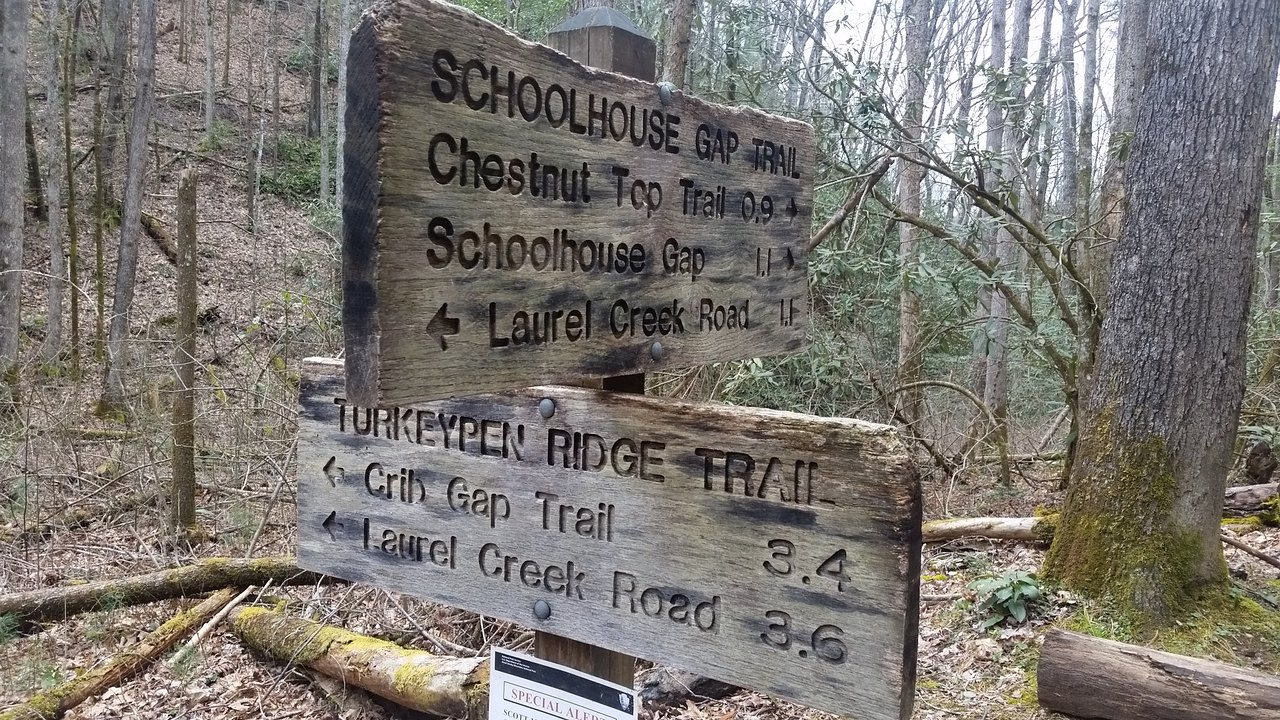
As the trail leaves the parking area, it climbs slightly along Spence Branch until it reaches Dorsey Gap.This is an old road that was supposed to connect Schoolhouse Gap to Bote Mountain Trail and, ultimately, Spence Field.
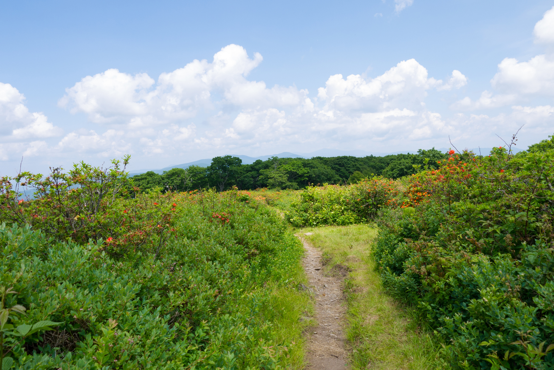
The trail is wide and well maintained for easy travel. Right before the gap, there is a marshy area on the right of the trail good for birding or wildflower viewing. After you pass the gap, a narrow trail leads off to an area known as Whiteoak Sink. Caves in the Whiteoak Sink area provide homes for bats, although most caves are closed due to the threat of White Nose Syndrome.
As the trail continues to climb slightly to Schoolhouse Gap, you meet the Chestnut Top Trail, a trail that leads down to the Townsend Y. The trail continues until it reaches Schoolhouse Gap and the park boundary. While there is no record of a school being at the gap, the name may refer to the fact that students walked through the gap in order to go to school in Townsend.

Recent Comments